


LAC VERT TANET AR

surceneux
User

Length
18.2 km

Max alt
1281 m

Uphill gradient
741 m
Km-Effort
29 km

Min alt
810 m

Downhill gradient
1129 m
Boucle
No
Creation date :
2023-10-08 08:00:58.063
Updated on :
2023-10-08 16:20:08.913
3h00
Difficulty : Medium

FREE GPS app for hiking
 SityTrail
IGN / Geographical institutes
SityTrail Plus
The world is yours!
About
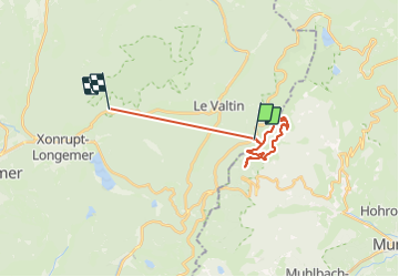
Trail Walking of 18.2 km to be discovered at Grand Est, Vosges, Le Valtin. This trail is proposed by surceneux.
Positioning
Country:
France
Region :
Grand Est
Department/Province :
Vosges
Municipality :
Le Valtin
Location:
Unknown
Start:(Dec)
Start:(UTM)
354445 ; 5327522 (32U) N.
Comments